Friday, November 20, 2015

The Kenai Peninsula and the Iliamna Volcano, Alaska


In 2012, I had a vacation to the Kenai Peninsula of Alaska.  The scenery is spectacular and I hope that you enjoy the photos and a bit of geology from my trip.

The map is from the website of the Alaska Volcano Observatory  https://www.avo.alaska.edu/ .  The map shows the location of volcanoes west of Cook Inlet.  The active and dormant volcanoes (Black Triangles on the map) are within the Aleutian chain.


Mount Iliamna is a dormant stratovolcano, but with eruptions at 300 and 400 years ago.  These were pyroclastic flows.  The top of the volcano is at an elevation of 10,015 feet.  Much of the volcano is glacier covered.  The volcano is still seismically active and has hot springs and fumaroles.  The volcano can be seen from the west side of the Kenai Peninsula.


Mount Iliamna viewed from the Kenai Peninsula across the Cook Inlet.


Informational poster at the entrance to the Harding Icefield Trail.


Exit Glacier and outwash.
Seward Harbor.
Seward Harbor as a water color.
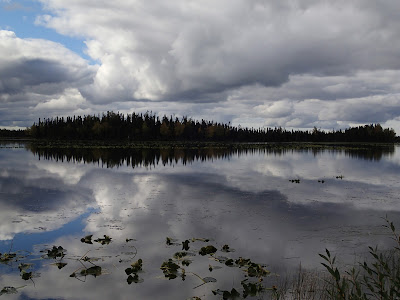
Photographic reflections from the Kenai Peninsula.


"Kenai Locals"


There is much to see and do on the Kenai Peninsula and in the Anchorage area.  I used to think that Alaska had to be overrated, however, that was before I visited the 49th state.  The other places that I have visited are Juneau, Skagway, Fairbanks, Sitka and McKinley (Denali).

I wish that everyone could get the chance to see Alaska!


Wednesday, November 11, 2015

A Photo Excursion to the Klondike Gold Fields, Yukon

The Klondike Gold Fields of the Yukon Territory have had an estimated placer gold production of 20 million ounces of gold.  The Yukon and Skagway, Alaska, are the location of the last major gold rush.  Since my first trip to the Yukon in November 2008, I have had several more trips including one in June of 2015.  The Yukon is a great region for tourists with hunting and fishing, site seeing, beautiful and rugged mountains, great rivers, wonderful restaurants in Whitehorse and Dawson City.  It is now a very popular destination for German, French and Asian tourists.

There has been considerable information written on the Klondike, so this is merely an introduction to the excitement of the Klondike Gold Rush and the scramble from Skagway to the Klondike from 1897 to 1900.

On the night August 16, 1986, gold was discovered by Skookum Jim , Taghish Charley, Shaaw Tiaa , and George Washington Carmacks (husband of Shaaw Tiaa).  The gold nuggets were found in Rabbit Creek, later renamed Bonanza Creek.  Carmacks and the others staked claims on the discovery.  The claims were filed at Forty Mile on the Yukon River north of the Klondike.  Carmacks also spread the news of their discovery.  Many more prospectors staked claims on Bonanza Creek and the surrounding area.

The placer gold was deposited in the drainage of the Klondike River, White Channel Gravel (Pliocene conglomerates with round pebbles and cobbles of white vein quartz), and in the modern channels of Bonanza and Eldorado Creeks.  The placer deposits of Bonanza and Eldorado Creeks are some of the richest in the world.

The enigma of the the Klondike is that a lode gold source for the placer gold has yet to be discovered.  There are only modest lode gold deposits in the bedrock of the Klondike Gold Fields.

Embroidered patch for the Klondike Gold Rush National Historic Park.


Stampeders packing their supplies over Chilkoot Pass near Skagway.


Satellite image of the Klondike District.


Dawson City with the Yukon River (left) and Klondike River (right) looking north.
Dawson City looking south.


Dredge tailings placer mining along the Klondike River (looking westerly).


White Channel Gravel overlying Klondike Schist (black rocks.)
Open cut mining of the White Channel Gravel.
Quartz veins in the Klondike Schist.
Gold nuggets from the Yukon.

Gold nugget formed from an aggregate of gold grains and quartz grains.

Gold dredge on Thistle Creek south of the Klondike District.
Drag line excavator on Thistle Creek, it was brought to the Yukon after it was used to build the Panama Canal.
Three abandoned river boats on the banks of the Yukon River.
Riverboat on the Yukon at Dawson City 2015.
Sourdough geoscientist from Alaska and a statue of "Kleopatra" from the Dawson Museum.
A Yukon sunset.


The following books on the Klondike are great reads...
  • The Illustrated Robert Service, 2006, distributed in Canada by PR Services Ltd., Whitehorse, Yukon, 1-866-648-4144.  Great poems by Robert Service and historic photos of the Klondike Gold Rush.
  • The Klondike Quest a Photographic Essay 1897-1899, Pierre Berton, 2005, The Boston Mills Press, 239p. Excellent text and photos of the Klondike experience.
  • The Streets were Paved with Gold, Stan Cohen, 2001(first printing 1977), Pictorial Histories Publishing Co., Inc., 202 p.  Mostly photographs, but also includes historic maps and newspaper articles on the Klondike discovery.
  • The Call of the Wild, Jack London with illustrations by Philippe Munch, 1996 (story first published in 1903), Penguin Books USA Inc., 126 p.  This is the classic story of the Klondike by Jack London.  This edition is beautifully illustrated with colored drawings and historic photographs.

The Yukon and Dawson City are worthy of your "bucket list."