Showing posts with label Geology. Show all posts

Friday, October 18, 2019

1986 Field Trip to the Fortitude Gold-Silver Mine, NV

In May 1986, I was working for Tenneco Minerals Company as an exploration geologist and visited the Fortitude gold skarn deposit in the Battle Mountain Range in Nevada. The deposit was owned by Battle Mountain Gold Corp. (BMG). The mine visit was part of a field trip part of GEOEXPO/86. The trips were add-ons to a symposium held in Vancouver, BC. The trip and symposium were sponsored by The Association of Exploration Geochemists and Geological Association of Canada. The field trips were lead by Harold (Hal) F. Bonham of the Nevada Bureau of Mines and Geology.

View northerly of the Fortitude open pit from August 1986 (Emmons).

One month earlier, July 1986, three Battle Mountain geologists: P.R. Wotruba, R.G. Benson, and K.W. Schmidt published a brief but informative description of the Fortitude deposit (Battle Mountain describes the geology of its Fortitude gold-silver deposit at Copper Canyon: Mining Engineering, p. 495-499). The benches are 20 feet high for scale.

This cross section of the Fortitude is from the above cited paper by Wotruba, et al. and the following description of the geology is summarized from the paper.


Fortitude gold-silver, sulfide-skarn deposit cross section looking due north by Battle Mountain Gold Corp. 1986.

The reserves reported by BMG in January 1985 were 11 million tons grading 0.154 opt gold and 0.83 opt silver containing 1.7 million ounces of gold and 9 million ounces of silver.

The gold-silver skarn deposit is located in the Copper Canyon area of the Battle Mountain Range. The center of the mineralized zone is occupied by an altered granodiorite pluton (Eocene, radiometric date of 38.5 Ma). An altered dike extends to the north from the Copper Canyon pluton and fills the Virgin fault. Hydrothermal alteration and metal zoning form concentric shells around the intrusion. The inner zone of alteration is potassic altering the granodiorite. The limit of this alteration is defined the limit of secondary biotite. Further out is phyllic and then propylitic alteration. Metal zoning outwards from the intrusion is: Cu+Au+Ag > Au+Ag > Pb+Zn+Ag. Fluid inclusion data indicate temperatures of >500 to 200 degrees centigrade.

The sulfide skarn is hosted by the Antler Peak Limestone (Pennsylvanian).  The deposit is stratabound (manto-like) and is distal to the source intrusion in Copper Canyon. The limestone occurs within other carbonate and clastic rocks of Permian and Pennsylvanian age. Thrust over these strata is the Havallah (previously called the Pumpernickel) sequence. The Golconda thrust is related to the Sonoma orogeny.

The mineralogy of the skarn consist of andraditic garnet, diopside, epidote, actinolite, tremolite, quartz and calcite. Sulfide mineral consist of pyrrhotite, chalcopyrite, pyrite, sphalerite, and galena. Sulfide content is locally of a massive nature. Owing to the pyrrhotite content the mineralization is magnetic and was reflected in a small aeromagnetic anomaly. This was part of the discovery story of the Fortitude deposit.


Monday, July 3, 2017

Brief History of the Theory of Plate Tectonics

I stumbled across my copy of the book Principles of Physical Geology written by Arthur Holmes in 1944.  He wrote the book while Professor of Geology and Mineralogy at the University of Edinburgh. It is interesting that he wrote the book in the United Kingdom during World War II.  The final chapter is on Continental Drift which is now called Plate Tectonics.  He discusses the work of Alfred Wegener in the early 1900's and includes some of Wegner's reconstruction of the continents through geologic time.  The final section is on the search for the mechanism for continental drift.  He put forth the idea of convection cells a mechanism for the drift of the continents.  He includes two cross section depicting the convection cells.  One section shows the mid-oceanic ridges as spreading centers creating new oceans.  It doesn't appear that he understood subduction zones.

It wasn't until the 1960's and 1970's that science proved that Wegener and Holmes were largely correct with their theory.  It required new technology to uncover the "secrets" of plate tectonics:  mapping of the ocean floors, marine magnetic surveys (using instruments designed in World War II to search for submarines), the discovery of the reversals of the earth's magnetic field, paleo magnetism, recognition that the mid-ocean ridges are spreading centers, a global network of sensors in the 1960's for the Nuclear Test-Ban Treaty of 1963, and deep sea core samples from the Glomar Challenger.


Dust jacket of Holmes' geology textbook.
 
Holmes' chapter on Continental Drift.
 
Wegener's reconstruction to the continents in Late Carboniferous, Eocene and Early Pleistocene (from Holmes,1944).
  
The cross sections from Holmes' chapter on Continental Drift.
Key Events in the Formation of the Theory of Plate Tectonics
  • 1596 Abraham Ortelius recognized that the coast of the Americas and Europe and Africa appear to have been joined a sometime and then pulled apart.
  • 1912 Alfred Wegner hypothesized that the continents had a onetime all been joined together.  He named the super continent Pangea.  He termed the process continental displacement.  Unfortunately during his lifetime the theory was not accepted by the scientific community.
  • 1929 Arthur Holmes proposed that convection currents were mechanism of the movements of the continents and the formation of new oceans.
  • 1950's  Mapping of the topographic features of the ocean floor reveals underwater mountain ranges in the mid oceans with great vertical relief and extending for thousands of miles.
  • 1960  Harry H. Hess, American geophysicist, proposed the idea that oceanic crust forms was from the mid-ocean ridges and spreads laterally in opposite directions.
  • 1961 Robert S. Dietz, American geophysicist, named Hess' process as sea floor spreading and further advanced the theory of plate tectonics. 
  • 1963 Frederick J. Vine and Drummond H. Matthews, British geologists, and Laurence W. Morley, Canadian geophysicist, discovered the "magnetic strips" that symmetrically parallel the spreading centers at the oceanic ridges due to the paleo magnetism and reversals of the earth's magnetic poles.
  • 1960's Global network of sensors it set up to detect nuclear tests as a result of the Nuclear Test-Ban Treaty signed in 1963.  The data revealed the pattern of earthquakes is concentrated along the continental edges.
  • 1968 The ship Glomar Challenger collects core samples from the Atlantic ocean and reveals the age of the sediments increase in age away from the spreading centers.
 
Alfred Wegener (1880-1930

 
Screen capture from YouTube from The Amoeba People, a humorous take on Wegner's lack of scientific acceptance until decades after his death by freezing in the ice field of Greenland.  Harry H. Hess at the blackboard during a presentation.
 
 
Arthur Holmes (1890-1965) Photo: 1912
 
Holmes published the second edition of Principles of Physical Geology in 1963. This when the concept of plate tectonics was becoming more widely accepted by the scientific community.  When he died in 1965 he was most remember for his working on radiometric dating and the geological time scale.  His work on plate tectonics as early as 1929 was largely forgotten.


Thursday, November 17, 2016

Pacific: Simon Winchester's New Collection of Essays on Geology, Colonies Lost, Nature and Wars


The UK's Simon Winchester, 72-year old best selling author, has recently released a new book about natural and human-caused events that occurred around and in the Pacific Ocean.  It is a fascinating read filled with bits of history and the natural events that took place in the Pacific.  It also brings to life some unimaginable stories about the formation of the Sony Corporation and the transistor radio.  There is a chapter on the discovery and confirmation of continental drift, now known as "Plate Tectonics."  The story of the discovery of the deep sea, black smokers and life in the deep ocean.

It is an eclectic collection of stories of non-fiction, written in easy-reading prose.


This is the table of contents of the book which I have made brief annotations of what the various chapters are about.  As you can read it is a very wide range of topics.  All the chapters are enjoyable and will improve your knowledge of many interesting events.  The book will be enjoyed by geologists, history buffs, environmentalists, military buffs, nerds and anyone desiring to learn about their world.

I highly recommend  the "Pacific."  If you like John McPhee's books you will enjoy Winchester's writing.

Other Winchester books that I have read and recommend are:  The Map That Changed the World, about William Smith's geologic mapping in the British Isles, Krakatoa, and The Man Who Loved China.  And there are many more that I have yet to read but plan to in the near future, specifically "Korea."

 
Thanks for viewing this post and please comment. dle

Friday, November 4, 2016

The Cascade Volcanoes as seen in Satellite Images


The Cascade volcanoes are a fantastic result of plates tectonics.  Seven of the volcanoes have erupted in the last 200 years and three of these have erupted in the last 100 years.  The eruption of Mount St. Helens on May 18, 1980 was both spectacular and tragic.  I am sure many of you saw some of the ash clouds and eruptions.  I saw it once from a passenger jet flying east from Seattle; mainly steam and some ash.

The Cascade volcanic arc extends northward from northern California, through Oregon and Washington, extending into British Columbia (Mount Garibaldi and Mount Meager).


Cascade volcanic arc formed by the subduction of the Juan de Fuca plate beneath the North American plate.  USGS


Map of the Cascade volcanoes, the historic eruptions are highlighted.


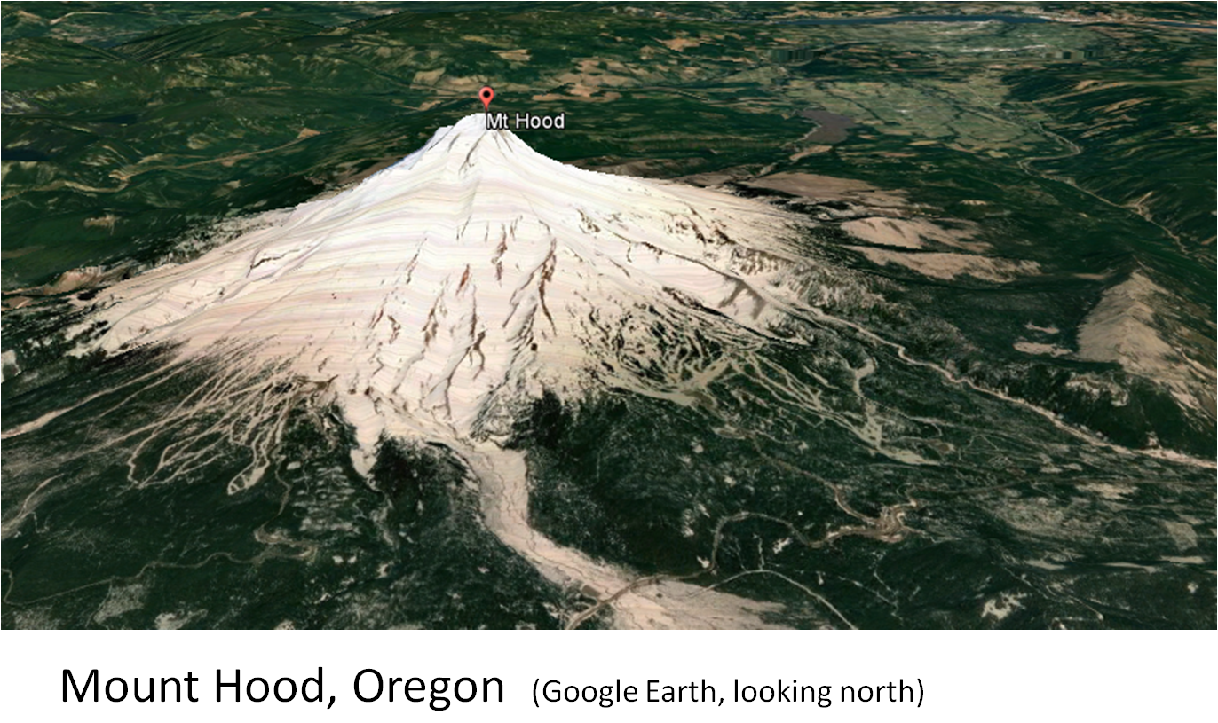
I have captured satellite images of the Cascade volcanoes that have had historic eruptions from Google Earth.  They are presented in the following as a slide show.


Oblique view of Mount St. Helens showing the various volcanic deposits and the lava domes (USGS).  The view is approximately the same as the satellite image in the previous illustration.


Note the well developed flow ogives (pressure ridges) emanating from the felsic volcanic dome field.


A first hand account of the eruption of Mt. St. Helens is available.  The book is:  Mt. St. Helens, Surviving the Stone Wind. The author is Catherine Hickson.


Catherine Hickson

Thursday, October 20, 2016

Corkscrew Mtn, Toroda Creek Graben, Washington

Corkscrew Mountain is an interesting geological formation composed of Tertiary basalt flows in northern Washington.  It is located 2.5 miles west of Toroda and north of Toroda Creek.  Volcanic rocks form many interesting landscapes.

Corkscrew Mountain shown on the Toroda USGS 7.5' topo.
 
The photos below show several basalt flows exhibiting columnar jointing along with the flow tops and bottoms.  The trough shape of the flows may indicate that they flowed down a gentle valley.  The image on the right is the authors concept of the original orientation of  the basalt flows.


Oblique view of Corkscrew Mountain viewed on Google Earth.
It is out of the way for most people.  But if you are in the area, it is worth a drive by, a look and a photo. 

Thanks to Tom Johnson, Kinross geologist, for pointing it out to me several years ago.

Wednesday, September 28, 2016

Borate Mining in Death Valley, California: 1960's to 2005


My first job out of college was in Death Valley.  I graduated from San Diego State University in August 1974 with a Bachelor of Science degree in geology.  My other job offer was for mud logging on the North Slope of Alaska.  The position in Death Valley was with Tenneco Mining Company, a subsidiary of Tenneco Oil, a subsidiary of Tenneco Inc.  Tenneco had acquired the borate project via the acquisition of Kern County Land Company in 1967.  The acquisition was made mainly for the fee land holdings in Kern County, California for their oil and gas holdings.

In 1960, Kern County Land purchased the claims from the Pacific Coast Borax with the famed 20 mule team wagons.  They paid $200,000 for the claims that contained the Boraxo, Billie and Sigma borate deposits.

Tenneco's foray into borate mining lasted until 1976 when it sold its borate properties to Owens Corning vis the subsidiary of American Borate Company (ABC).  Owens Corning was the largest customer to the borate products.  In 1990, Owens Corning spun-off/sold ABC.  ABC intermittently produced borates from the Billie mine from 1990 until 2005.


Borate deposits of Death Valley and the Armargosa area (Source:  Barker and Barker, 1985).

The famous 20 Mule Train hauling borates.


The Boraxo and Sigma pits were mined by Tenneco in the 1970's.  The borates were trucked the mill in Nevada north of  Death Valley Junction.  Exploration and development drilling conducted within the monument.  The Billie deposit was drilled out on a 100-foot rectangular grid.  Conventional rotary drilling was done until borates were encountered and then the deposit was core drilled.  Tenneco was not allowed to build drill roads, so the drill and 4WD vehicles were driven cross country over the boulder-strewn wash.

The borate deposits of Death Valley are in the Pliocene Furnace Creek Formation.  They are stratiform deposits that form in a lacustrine environment.  The "ore" is composed of colemanite, probertite and ulexite.  Typical grade is approximately 22% boron.  The Boraxo and Billie mines yielded beautiful colemanite crystals some of which are honey colored.

Three colemanite specimens and one probertite (lower left); collected from the Boraxo pit in 1974.
The Billie deposit ranges from 200 to 1,350 feet below the surface.  It was 3,700 feet in length, 900 feet in width and up to 250 feet in thickness. 

Satellite image of a portion of Furnace Creek showing the Boraxo and Sigma open pit borate mines and the surface projection (approximate) of the Billie borate deposit that was mined underground by American Borate Company.  The north-south road that leads to the shaft is immediately east of the National Monument boundary.


                                              Ken's Blog with Photos of Death Valley

 
Screen shot of YouTube video of a flyover of the Billie mine (click on link below).
Billie mine drone flyover by Mathew Priest

Cross section of the Boraxo deposit.  The deposit was mined from an open pit by Tenneco Mining and then the portion that extends down-dip from the pit was mined underground with a continuous miner.  (Source:  Wilson, 1976).


Underground mine development for the Billie mine, Agapito is tasked with closure of the mine for  American Borate Company (Source:  Agapito Associates, Inc. website).
A front-page article in the Los Angeles Times on September 17, 1975 by Robert A. Jones warning the Tenneco Mining may someday have an open pit strip mine in the view of the Zabriskie Point scenic turnout.  The news item was the result of claim staking by Tenneco in the vicinity of scenic area.  The monument's superintendent James B. Thompson was quoted saying "We'll be able to stand right here and watch trucks haul away part of the view.  And if the legal situation doesn't change, we'll be helpless to stop it."
 
 Death Valley Nation Monument was an exception in that mining was allowed because of existing talc and borate mines at the time that it was designated as a monument by President Herbert Hoover in 1933.  In 1994, Death Valley National Park was created.
 
Front-page photo from the LA Times on September 15, 1975.
 Additional articles in the Times in 1975 and 1976 resulted in the banning of mining in Death Valley and eventually its status was changed to a National Park.  However, American Borate Company was eventually allowed to mine the Billie borate deposit since it was an  underground mine.  The shaft and head frame were just east of the monument and the only surface structure for the mine in the monument was the secondary escape way.
 
 
Zabriskie Point Death Valley has not be trucked away as predicted by the LA Times (Photo 2007).
The geologists that worked for Tenneco Mining were a great group of new geo's, mostly fresh out of college.  They had brand new geology degrees from southern California schools.  Many went on to have careers in mining, exploration, New Mexico Tech and the USGS.
 
Suggested Reading:
 
 
Barker, C. E., and Barker, J. M., 1985, A re-evaluation of the origin and diagenesis of  borate deposits, Death Valley region, California; in J. M. Barker and S. J. Lefond, eds., Borates-Economic Geology and Production: Symposium Proceedings, SME-AIME, New York, p. 101-35.
 
Barker, J. M., and Wilson, J. L., 1976, Borate deposits in the Death Valley region: Nevada Bureau of Mines and Geology, Special Report 26, p. 22-32.
 
McAllister, J.F, 1970, Geology of the Furnace Creek borate area, Death Valley, Inyo County, California:  California Division of Mines and Geology Map Sheet 14, 9 p.  1:24,000.
 
Wilson, J.L., 1976, Geology and engineering aspects of Boraxo pit, Death Valley, California:  unpublished M.S. thesis, University of Southern California, 95 p. 


Sunday, December 6, 2015

An Eclectic Collection of Photos with Computer Filtered Versions

This post is a collection of photos taken over many years.  I think that you will find then interesting and enjoy seeing them.

Over the last several years I have been using a few different photo editing programs.  I started with Windows Picture It 7, which is no longer available, however, Microsoft has replaced it with another that is free and available online.  Another app or program that is great is Picasa 3 that is also available free online.  And, Picasa is good for organizing your photos.  And, of course there is Adobe Photo Shop.


I hope this gives you some good ideas on how to enjoy your photography. 

Goodbye for now!